Live stream: mobilemic8
Recording: Berlin Königsheide, forest pond ambience - udo noll
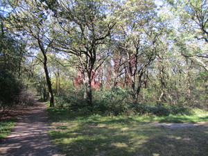
Berlin, Königsheide
radio aporee - udo noll
Latitude: +52.454839°
Longitude: +13.485956°
Live microphone at Königsheide inner city forest, Berlin
by udo noll
by udo noll
The Königsheide was originally part of the Köllnische Heide, which extended from Neukölln (Rixdorf before 1912, Neukölln from 1920) to Köpenick. As industrialization progressed, parts of this contiguous forest area were cleared for housing and industrial construction. The forest stands on somewhat elevated valley sands, which are thus drier than the Spree floodplain to the northeast and also than the adjoining former Rudow meadows to the west, formerly a marshy area. Since the settlement of the valley areas of the Spree in the late Middle Ages, large areas of the Köllnische Heide have been used as pasture land; since the 19th century, the forest areas had to give way to the development of residential and commercial areas and associated infrastructure facilities in the course of urbanization and the formation of large cities around Berlin. The remnants in the northwest of the district of Johannisthal, bordered by the Königsheideweg and the Südostallee, are the Königsheide, an area of about 110 hectares, which today serves as a nature reserve and water conservation area for general recreation.