Live stream: serra_grande_ponta_do_ramo.mp3
Ponta do Ramo, Ilhéus, Bahia
Archipel Stations Community Radio
Latitude: -14.519958026738758°
Longitude: -39.04799402187746°
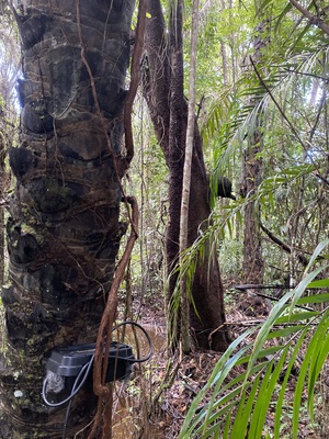
A rural preservation area / human occupation in the brazilian Mata Atlantica's (rain forest) coastal line near Ilheus
Close by the Serra do Conduru State Park (PESC) in the state of Bahia, less than 1km to the coastal line. Situated in a region that encompasses part of what remains (7%) of the original Atlantic Forest, it is recognised as a place of superlatives, with a high degree of endemism and one of the world’s greatest levels of biodiversity.
Established by State Decree No. 6,227 of 21 February 1997, the park was created as an environmental compensation measure for the construction of the section of the BA-001 motorway linking the municipalities of Ilhéus and Itacaré.
These lands, originally inhabited by indigenous peoples of the Gueréns and Tupiniquins ethnic groups, extend across the municipalities of Ilhéus, Itacaré and Uruçuca, and form part of a sanctuary for rare and endemic species. At the time of the demarcation, 458 distinct tree species were found within a single hectare. This discovery gained international attention and established the site as a biodiversity hotspot. The scientific profile and recognition generated by the discovery convinced the Government of Bahia to demarcate and conserve the area – initially covering around 7,000 hectares – in response to a request from researchers. The Serra do Conduru was expanded to 9,275 hectares through a process of expropriation and land regularisation established by State Decree No. 8,702 of 4 November 2003.